The Lincoln Institute of Land Policy in the U.S. recently published a report called ‘Making Room for a Planet of Cities‘. The report discusses the results of a five-year study on global urban expansion that was funded by the World Bank. They use a range of mapping techniques to explore how the world’s cities have evolved, drawing on built up area maps, historical population density data, and urban land cover maps to explore urban spatial structure and change over time.
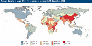
It begins by charting the methodology used to study global urban expansion followed by a perspective on patterns in global density. The report then moves on to issues of city fragmentation and projections on how cities might grow by 2050. The research notes that currently built-up area densities in developing countries are double those seen in Europe and Japan and those densities are double those seen in the United States, Canada, and Australia.
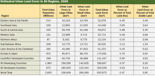
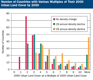
It also notes that global densities have been declining for more than a century and fragmented open spaces in cities have declined slowly since 1990. This coincides with an annual growth rate of urban land cover that is twice that of the urban population between 1990 and 2000. Projections in the report go on to note that based on current estimates the world’s urban population is expected to double in 43 years while urban land cover will double in only 19 years.
In conclusion, the report highlights five key reasons why current efforts at containing urban growth are not working in developing countries, including urban growth boundaries that are too tight-fitting, infill development goals that are too optimistic, densification processes that are considered unnecessary, an over reliance on regulation, and an under supply of arterial roads that can be used for public transit.
Have a look at the report and some of the nice maps and see what you think!


